


Most people who collect rocks first meet geology through the finished object.
They see the amethyst cluster, the polished agate, the jade bangle, the rhodonite cabochon, the quartz point, the fossil fish, or the mineral specimen sitting under lights in a rock shop. By that point, the material has already been found, extracted, sorted, cleaned, transported, priced, and presented. The hard part has been made invisible.
That invisibility creates a distorted picture of how minerals are actually found.
A rock shop makes geology look abundant. A gem show makes it look organized. A crystal website makes it look like the earth is basically a warehouse full of meaningful objects waiting to be purchased. But in the field, geology is not organized for human convenience. Most ground is barren. Most interesting-looking rocks are not valuable. Most leads go nowhere. Most prospecting days produce more questions than answers.
Technology has changed that, but it has not changed it in the way people often imagine.
Modern tools do not remove the need to understand rocks. They do not magically tell you where the crystals are. They do not guarantee a discovery. What they do is give the prospector better ways to narrow the search, compare clues, eliminate bad ground, and decide where field time is actually worth spending.
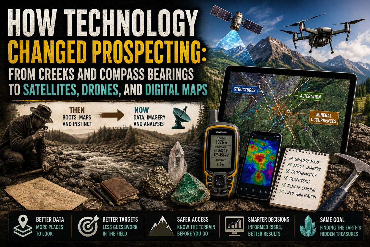
The old prospector had boots, patience, local knowledge, a compass, a hammer, paper maps, and a willingness to follow creeks, ridgelines, float, stains, veins, and rumours. The modern prospector may still use all of those things, but now they can also work with satellite imagery, GPS, digital claim maps, mineral occurrence databases, government geology maps, geochemical surveys, geophysical data, LiDAR, drones, and decades of publicly filed exploration reports.
That is a massive change.
It means that before someone hikes into the bush, drives a logging road, flies into a claim by helicopter, or spends money on exploration, they can often do days or weeks of research from a computer. In British Columbia especially, this matters because the province is large, mountainous, forested, heavily glaciated in places, and geologically complicated. You cannot just wander randomly and expect the province to reward you.
You need clues.
Technology gave prospectors more clues.
Prospecting Used to Start Almost Entirely in the Field

Before digital tools, prospecting was much more physical and much more local.
A prospector paid attention to what the land exposed naturally. Creeks, rivers, cliffs, road cuts, landslides, talus slopes, shorelines, and freshly broken rock were important because they revealed what was otherwise hidden under soil, trees, moss, snow, or glacial material.
A creek was not just water. It was a sampling system. Everything upstream had the potential to contribute pieces of itself into that drainage. Heavy minerals, quartz fragments, sulphides, jasper, agate, garnet, epidote, magnetite, placer gold, and other resistant material could move downhill and collect in bars, bends, cracks, and traps.
That is why so much early prospecting followed water.
A piece of interesting float could create what might be called a breadcrumb trail. If the same material became more common upstream, a prospector might follow it toward its source. If the float disappeared, changed character, or only appeared below a certain tributary, that also meant something.
This is still relevant today. If you are collecting minerals or lapidary material, float matters. If you find one piece of rhodonite, agate, jasper, prehnite, quartz, epidote, or actinolite-bearing rock in a creek, that does not mean you found the source. It means you found evidence that the material exists somewhere in the drainage or was transported there by older geological processes. You still have to interpret how it got there.
Old prospectors worked from these kinds of clues constantly:
-
rusty iron staining
-
quartz veins
-
sulphide minerals
-
green alteration
-
heavy black sands
-
unusual float
-
contact zones between different rock types
-
old pits, trenches, shafts, and blasted exposures
-
local stories from miners, loggers, ranchers, and other prospectors
The weakness of that old system was not that it was stupid. It was often highly observant. The weakness was that it was limited by what one person could see, remember, access, and afford to investigate.
Modern prospecting expanded the field of view.
A Rough Timeline of Prospecting Technology
Prospecting did not change all at once. It changed in layers. Each new tool gave geologists and prospectors another way to see the ground before digging into it.
|
Period |
Development |
What changed |
|
1800s |
Government geological surveys |
Canada’s Geological Survey was founded in 1842 to assess and map the country’s mineral wealth, creating the foundation for organized public geology. |
|
Late 1800s to early 1900s |
Systematic geological mapping |
Prospecting became less dependent on rumours and isolated discoveries. Rock units, faults, mineral belts, and mining districts could be compared regionally. |
|
1920s onward |
Aerial photography |
Canada’s National Air Photo Library includes air photos dating back to the 1920s, and aerial images became important for mapping terrain, access, structures, drainage, and exposure. |
|
Mid-1900s |
Geochemistry |
Soil, stream sediment, and rock sampling made it possible to follow trace-element clues that were not visible to the eye. |
|
Mid-1900s onward |
Geophysics |
Magnetic, electromagnetic, gravity, radiometric, and induced polarization surveys allowed exploration teams to detect buried structures and mineral systems indirectly. |
|
1960s and 1970s |
Plate tectonics |
Geologists gained a better framework for understanding volcanic arcs, subduction zones, terranes, mountain building, and why mineral belts occur where they do. |
|
1947 onward in BC |
Assessment reports |
BC exploration companies have filed technical assessment reports since 1947. These reports now form a huge public record of past geology, geochemistry, geophysics, drilling, and prospecting work. |
|
Late 20th century |
Digital mineral databases |
Tools like MINFILE made mineral occurrences searchable by location, commodity, geology, deposit type, and exploration history. |
|
1990s to 2000s |
GPS becomes common |
GPS made field locations far more accurate. In May 2000, the U.S. ended Selective Availability, improving civilian GPS accuracy worldwide. |
|
2000s onward |
Satellite imagery and online mapping |
Prospectors could study access, exposure, terrain, snow cover, vegetation, roads, rivers, and alteration patterns before entering the field. |
|
2010s onward |
LiDAR becomes more accessible |
High-resolution elevation data made it easier to see landforms, old workings, roads, benches, scarps, and terrain features hidden by forest. |
|
2010s onward |
Drones |
Small operators gained a cheaper way to inspect cliffs, talus slopes, road washouts, inaccessible outcrops, and claim areas before risking people or money. |
|
2020s onward |
Machine learning and large datasets |
Exploration increasingly combines remote sensing, geochemistry, geophysics, mapping, and historical records into predictive models, though field verification still decides whether the idea is real. |

1. Better Geological Mapping Changed the Starting Point

One of the biggest changes in prospecting came from better geological mapping.
A geological map is not just a drawing of rock types. It is an argument about how the land was built. It shows bedrock units, faults, intrusions, volcanic belts, sedimentary basins, metamorphic rocks, contacts, structures, and sometimes known mineral occurrences.
For a rock collector, this matters because minerals are not randomly scattered through the province. They form in geological settings. Jade, agate, rhodonite, garnet, quartz crystals, fossils, sulphides, zeolites, and other collectible materials all have geological contexts.
You may still find the odd interesting stone anywhere, especially in glacial or river material, but source deposits are not random.
In British Columbia, the British Columbia Geological Survey has been producing maps and reports for more than a century. Its publication catalogue includes reports and maps going back to 1895, and the province now acts as custodian for public provincial geoscience data.
That kind of public geological record is easy to take for granted. A modern rockhound can look up geology that earlier prospectors either had to discover themselves or learn through word of mouth. That does not mean the map tells you exactly where to dig. It means it can tell you whether your idea is geologically reasonable before you start.
If you are looking for fossil-bearing sedimentary rocks, you should care whether the area is sedimentary, volcanic, intrusive, or metamorphic. If you are looking for jade, you should care about ultramafic rocks and the right metamorphic setting. If you are looking for agate, you should care about volcanic rocks, cavities, silica, and weathering. If you are looking for quartz crystals, you should care about veins, pegmatites, hydrothermal systems, fractures, and cavities.
The map does not replace fieldwork. It improves the question you bring into the field.
2. Aerial Photography Let Geologists See Patterns from Above
Aerial photography changed prospecting because it allowed geologists to see the landscape as a system.
From the ground, you see one road cut, one creek bank, one talus slope, or one outcrop at a time. From above, you can see drainage patterns, ridges, lineaments, old roads, landslides, fault traces, vegetation changes, and the shape of the terrain.
This matters because geology often expresses itself as pattern.
A fault may create a straight valley. A resistant rock unit may form a ridge. A softer unit may weather into a depression. A contact between rock types may influence slope, vegetation, water movement, or exposure. Old placer workings, trenches, pits, and access roads may be visible from above even when they are difficult to understand from the ground.
For specimen collectors, aerial views can also help identify practical collecting environments:
-
fresh road cuts
-
talus fans below cliffs
-
exposed bedrock along shorelines
-
gravel bars
-
quarry areas
-
landslide scars
-
old workings
-
access routes into promising geology
This is one of the places where technology does not feel dramatic, but it changes the workflow completely. Instead of walking blind, you can study the land before entering it.
3. Geochemistry Made Tiny Clues More Useful
Geochemistry changed prospecting by making trace evidence more meaningful.
Not every deposit is exposed at the surface. Sometimes the source is hidden under soil, forest, glacial till, or younger sediments. But water, weathering, erosion, and chemical movement can spread small traces of elements away from the source.
That is why prospectors and exploration companies collect stream sediment samples, soil samples, rock samples, and sometimes water samples. These samples can be analyzed for elements that may indicate nearby mineralization.
For example, a prospector looking for gold might pay attention not only to gold itself, but also to associated elements depending on the deposit type. Exploration geologists may look for pathfinder elements, alteration signatures, or unusual concentrations that point toward a larger system.
This is also where hobby collectors need to be careful. A geochemical anomaly is not the same thing as a mine. It is not the same thing as a good collecting site. It is a clue.
An anomaly means something is unusual compared to background levels. That unusual result may be meaningful, or it may be misleading. It may come from a real mineralized source, contamination, transported material, a small insignificant occurrence, or a system that is interesting scientifically but useless for collecting.
Still, geochemistry changed the scale of prospecting because it allowed people to follow evidence that the eye could not see.
4. Geophysics Let Prospectors Search Beneath the Surface
Geophysics changed prospecting by allowing people to detect physical differences in the ground indirectly.
Different rocks and mineralized zones can vary in magnetism, density, conductivity, radioactivity, chargeability, and other measurable properties. Geophysical surveys do not show a crystal pocket or a gem vein like an X-ray. They show contrasts.
Those contrasts can matter.
Magnetic surveys may help identify certain rock types, structures, buried intrusions, or magnetite-rich zones. Electromagnetic surveys can help detect conductive bodies such as some sulphide mineralization. Gravity surveys can reflect density contrasts. Radiometric surveys can help map potassium, uranium, and thorium responses in surface materials. Induced polarization can help detect disseminated sulphides in some exploration contexts.
The Geological Survey of Canada continues to produce authoritative geoscience supporting mineral exploration and other land-use decisions, and federal geoscience tools include geological, geophysical, and geochemical data resources for understanding Canada’s landmass.
For a rock enthusiast, the important point is this: geophysics does not usually find pretty specimens. It finds physical patterns that may indicate the right geological conditions.
That is the difference between collecting and exploration.
A collector asks, “Where can I find a good piece?”
An exploration geologist asks, “What does the whole system look like, and where is the highest-probability target?”
Those are related questions, but they are not the same question.
5. Plate Tectonics Changed the Meaning of Mineral Belts
One of the largest intellectual breakthroughs in geology was plate tectonics.
Before plate tectonics, geologists could describe many rock units and mineral occurrences, but they did not have the same global framework for understanding why certain geological belts formed where they did. Plate tectonics helped explain subduction zones, volcanic arcs, mountain building, oceanic crust, accreted terranes, rifting, collision, and the repeated recycling of the earth’s crust.
This matters enormously in British Columbia.
BC is not one simple block of rock. It is a complicated province built from terranes, volcanic arcs, sedimentary basins, intrusions, metamorphic belts, faults, and accreted fragments of crust. That complexity is part of why BC has such diverse mineral potential.
It is also why a beginner can get overwhelmed quickly.
For collectors, plate tectonics explains why different regions produce different kinds of material. Fossils, jade, copper minerals, gold, quartz, agates, zeolites, garnets, skarns, serpentinites, and volcanic rocks are not all part of one simple story. They belong to different geological environments.
Once you understand that, collecting becomes less random.
You stop thinking, “Where are the cool rocks?”
You start thinking, “What kind of geological environment produces the material I am looking for?”
That is a better question.
6. GPS Changed Field Accuracy
GPS changed prospecting in a very practical way: it made location precise.
Older prospectors relied on paper maps, compass bearings, landmarks, claim posts, blazed trails, flagged routes, memory, and hand-drawn notes. Good field people could be remarkably accurate, but there was always room for confusion. A creek fork might be misremembered. A ridge might look different in fog. Snow, logging, fire, road building, and forest regrowth could erase familiar markers.
GPS changed that.
Now a prospector or rockhound can record exact locations for samples, outcrops, float trains, old workings, claim boundaries, trails, roads, and hazards. This allows information to be revisited, shared, mapped, and compared.
For specimen collecting, GPS has also changed public behaviour. People now share coordinates online, sometimes carefully and sometimes irresponsibly. YouTube videos, blog posts, forums, and social media can turn a once-obscure collecting area into a heavily visited site.
That has benefits and consequences.
It helps beginners get outside and find material. It also increases pressure on collecting sites, creates land-access issues, and sometimes encourages people to treat geology like a scavenger hunt instead of a discipline.
A GPS coordinate can take you to a place. It cannot teach you what you are looking at when you arrive.
7. Digital Databases Changed the Research Process

This may be the biggest change for modern BC prospecting.
British Columbia has public tools that allow people to research mineral occurrences, assessment reports, maps, and historical exploration work before entering the field.
MINFILE is BC’s mineral inventory database. It allows users to search mineral occurrences by geological and exploration parameters and access reports that can include summaries, details, inventory information, and production history.
ARIS, the Assessment Report Indexing System, is a collection of technical assessment reports and data filed from mineral exploration and development properties across British Columbia. These reports have been submitted by industry since 1947 and can include geology, geophysics, geochemistry, drilling, prospecting, and other exploration work. Approved reports are kept confidential for one year before becoming public.
For a serious rockhound or small prospector, this is a major advantage.
You can look up old showings. You can see what work was done. You can find reports from companies that already spent money sampling, mapping, trenching, drilling, or surveying an area. You can compare the geology of one occurrence to another. You can see whether a mineral occurrence was a minor showing, a past producer, a developed prospect, or just an interesting note.
That does not mean every MINFILE occurrence is worth visiting.
Many are remote. Some are on private land, active claims, parks, restricted areas, dangerous terrain, or places with no practical access. Some were historically interesting but not collectible. Some are poor locations for specimens because the mineralization is microscopic, disseminated, weathered, blasted, buried, or industrial rather than aesthetic.
But as a research tool, this is still powerful.
It lets a collector move beyond “someone told me there are crystals there” and begin asking better questions:
-
What rock unit is this in?
-
What minerals were actually reported?
-
Was the material visible or microscopic?
-
Was there production?
-
Was it drilled?
-
Were there old trenches or workings?
-
Is the location accessible?
-
Is the land open to collecting?
-
Are there similar geological settings nearby?
That is the difference between casual rockhounding and informed prospecting.
8. Satellite Imagery Made Regional Prospecting Easier
Satellite imagery made prospecting more efficient because it allowed people to examine huge areas before physically entering them.
A satellite image can show roads, cutblocks, rivers, cliffs, snow cover, vegetation, exposed slopes, landslides, glacial margins, gravel bars, and large-scale landforms. In some types of mineral exploration, specialized remote sensing can also help identify alteration minerals or surface expressions associated with mineral systems.
A review of remote sensing in mineral exploration notes that satellite and airborne datasets are used to map geological features such as lithological units, alteration types, structures, and indicator minerals, and that the growth of remote sensing data has encouraged more advanced processing methods.
For the average rock collector, the simplest use is still access and exposure.
Where is bedrock exposed?
Where are the cliffs?
Where has a road been cut into the hillside?
Where has logging opened access?
Where are the creeks and gravel bars?
Where has a glacier pulled back?
Where are the old workings visible?
In BC, satellite imagery is especially useful because access changes constantly. Roads wash out. Logging roads are deactivated. Snow lingers. Fires expose ground. Landslides reveal new rock. Glaciers retreat. A place that was inaccessible or covered in ice decades ago may become newly exposed, while another place may become blocked by terrain, gates, growth, or regulation.
For mineral and specimen collecting, newly exposed ground matters. Fresh exposure is often where the best clues appear.
9. LiDAR Changed What We Can See Through Forest
LiDAR is one of the more important modern tools in forested terrain.
LiDAR stands for Light Detection and Ranging. It is an active remote sensing technology used to map the earth’s surface in high detail. British Columbia’s LidarBC initiative provides open public access to LiDAR data and associated datasets collected by the provincial government.
The practical value is that LiDAR can reveal subtle ground features that may be hidden or difficult to see under forest cover. It can help show terrain, benches, scarps, channels, old roads, pits, trenches, landslides, and other landforms with much more clarity than ordinary air photos in some environments.
For prospecting, this matters because BC is heavily forested in many areas. A historical trench, shaft, trail, or road may be nearly invisible on the ground until you are standing on it. Under trees, even aerial photos can hide useful features.
LiDAR helps separate the shape of the land from the clutter sitting on top of it.
For rockhounds, LiDAR can be useful when trying to understand:
-
old mine workings
-
historical access roads
-
creek terraces
-
landslide scars
-
glacial landforms
-
benches above rivers
-
possible bedrock exposure zones
-
terrain hazards
-
lineaments and structural trends
It still does not tell you whether there is good material to collect. It tells you where the ground deserves a closer look.
That distinction matters.
10. Drones Gave Small Prospectors a Cheaper First Look
Drones changed prospecting by making low-altitude visual inspection much easier.
In steep country, a drone can inspect cliffs, gullies, talus slopes, road cuts, claim areas, exposed veins, landslides, and inaccessible outcrops without sending a person into unsafe terrain. It can help document changes from year to year. It can help plan access. It can help photograph exposures that would otherwise require climbing, rope work, or helicopter time.
For a small operator, this is a meaningful shift.
A helicopter may still be necessary in remote mountain areas, especially in BC, but a drone can help answer smaller questions once you are near the area. Is the outcrop continuous? Is there fresh broken rock? Is the creek passable? Is the road washed out? Is the talus slope worth climbing? Is there an exposure above the tree line that deserves a closer look?
Drones also help with safety. A collector may be tempted to climb toward something that looks interesting from below. A drone can show whether the route is dangerous, unstable, or pointless before someone risks themselves for a pocket of quartz that may not even exist.
Again, the tool does not replace judgment. It extends vision.
The Modern Prospector Stacks Clues
The biggest change in prospecting is not one single tool. It is the ability to stack evidence.
A modern prospector might start with a geological map, then compare that with MINFILE occurrences, ARIS reports, satellite imagery, claim maps, road access, topography, LiDAR, old geochemical surveys, and field observations.
Each layer adds context.
One clue alone may not mean much. A rusty outcrop may be nothing. A quartz vein may be barren. A creek sample may be misleading. An old report may be exaggerated. A mineral occurrence may be too remote, too small, or too poor to matter. A satellite image may show exposure but not quality.
But when several clues point in the same direction, the ground becomes more interesting.
This is what separates informed prospecting from wandering.
A casual rockhound may ask, “Where can I go find something?”
A better question is, “What evidence suggests this area has the kind of material I want, and where would that material most likely be exposed?”
That question forces you to think like geology is a system, not a treasure map.
What This Means for Mineral and Specimen Collectors
Most rock enthusiasts are not trying to open a mine. They want good specimens, lapidary rough, crystals, fossils, agates, jaspers, jade, quartz, or unusual material they can collect, cut, display, or understand.
That is a different goal from industrial mineral exploration.
A mining company may be interested in low-grade copper, gold, molybdenum, lithium, rare earths, industrial minerals, or other resources that have no visual appeal to a collector. Some deposits are economically important but boring to look at. Some beautiful specimens have no industrial value. A glittering mineral specimen and an economic ore body are not the same thing.
This is where rock shops often fail to educate people.
The retail side shows the attractive endpoint. It rarely shows the geological filtering process that got the material there. A table full of crystals does not show the barren ground. It does not show the failed trips. It does not show the sorting, broken pieces, access problems, claim rules, safety issues, fuel costs, or the difference between a pretty mineral and a mineable deposit.
For collectors, technology can help in several practical ways:
It can help you understand why a material occurs in one region and not another.
It can help you avoid wasting time in the wrong rock type.
It can help you distinguish between a known collecting site and a true source area.
It can help you see whether material in a creek likely came from nearby bedrock or was transported.
It can help you understand old reports instead of relying only on online rumours.
It can help you graduate from “I found a cool rock” to “I understand the geological setting that produced this rock.”
That is a major step.
Technology Did Not Make Prospecting Easy
There is a dangerous misconception that modern tools make discovery easy.
They do not.
They make research easier. They make mapping better. They make location more accurate. They make access planning more efficient. They help identify patterns. They help reduce wasted effort.
But they do not remove uncertainty.
You can study every public report, mark every old showing, inspect every satellite image, and still come home with nothing. That is not failure. That is prospecting. The earth is not obligated to make its best material easy to find.
This matters especially for beginners. Many people approach rockhounding with retail expectations. They have seen bins of tumbled stones, shelves of minerals, and online listings with names and prices. Then they go outside and find mostly grey, brown, black, broken, weathered, ordinary-looking rock.
That is normal.
Most rock is ordinary. The interesting pieces are the exception. The more you understand geology, the better you become at recognizing those exceptions.
Technology helps, but the eye still has to be trained.
The Best Tool Is Still Interpretation
The last hundred years of technology changed prospecting dramatically. Paper maps became digital. Field notes became GPS points. Aerial photos became satellite layers. Hidden terrain became visible through LiDAR. Old reports became searchable. Drones gave prospectors a safer first look at difficult ground. Geochemical and geophysical surveys made invisible clues measurable.
But the most important skill is still interpretation.
A database can tell you that a mineral occurrence exists. It cannot tell you whether the trip is worth your time.
A satellite image can show you an exposed slope. It cannot tell you whether the rock will cut well.
A drone can show you a quartz vein. It cannot tell you whether the crystals inside survived.
A geochemical anomaly can show unusual elements. It cannot tell you whether there is a collectible specimen.
A GPS coordinate can take you to the spot. It cannot teach you what the spot means.
That is why technology should not make rock enthusiasts lazier. It should make them sharper.
The best collectors are not just people with secret locations. They are people who learn how to read the land. They notice float. They understand rock types. They pay attention to weathering. They compare maps to what they see in the field. They know that a polished stone in a shop is the final chapter of a much longer geological story.
Modern prospecting is not magic. It is not guessing either.
It is the disciplined stacking of clues until the ground becomes worth testing.
For anyone who loves minerals, crystals, fossils, or lapidary material, that is the side of geology worth learning. Not just what the stone is called after it reaches the shelf, but how the earth made it, how people found it, and why most of the search still happens long before anything beautiful ends up in your hand.